Synergies for city resilience within surface water management system in Khulna: Part-2
SURVEYRESILIENCEURBAN DESIGN
Muhammad Golam Sami
12/10/20187 min read

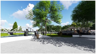
Image: Design Proposal by Muhammad Golam Sami ( Rendered in 2018)
[This blog is a compilation of Team Flood Crew members Muhammad Golam Sami, Alif Sanim, and Nomrota Sarker Tapti from KUET's research study, and it is the winning research project powered by Mott Macdonald and Khulna City Corporation.]
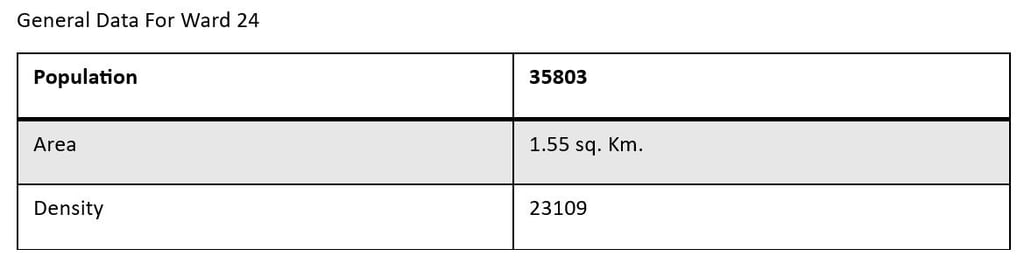
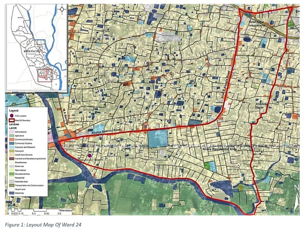
Part-1: Study on Water Logging Problem in Ward No. 24, Khulna City Corporation, Bangladesh.
A seminar hall is a location where a small group of students meets frequently under the direction of a tutor, professor, etc., to share knowledge, discuss theories, etc., or one such meeting or the location where it is held, or a more challenging course for postgraduates, or any gathering for conversing or exchanging information.
Auditoriums, multipurpose halls, and seminar halls all have standard requirements that must be met to be designed, and a formal study is required to ensure that these requirements are adequately met. The standard specifications of the three halls are shown in the chart below:
We will detail the auditorium standard requirements in this study and why the auditorium standard will direct us on how to design other halls.
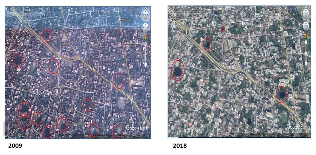
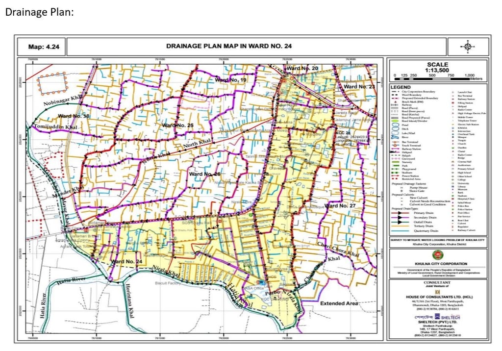
Drastic Reduction of Water bodies in the hotspots
Hotel Royal Node:
Area of reduced canals: 2-3 acres approx.
Main Cause: Ignorance of the Authority
Secondary Impacts:
• Disruption Of Traffic Movement
• Disruption Of Normal Life
• Damage Of Roads
• Damage of Substructure of Pucca Houses
• Damage of Household Goods
• Damage of Underground Line Services
• Water Pollution
• Increase of Water Borne Diseases
• Damage of Trees and Vegetation
• Economic Problem
• Overflow of Ponds
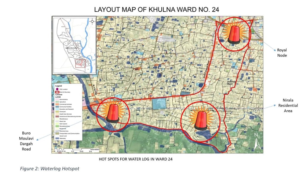

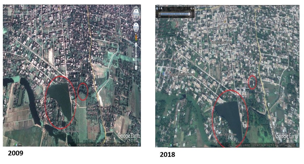

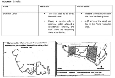
Nirala Residential Area
Area of total reduced canals: 4.85 acres
Responsible plots for landfilling: are 687, 5689, 5699, 5726, 5728, 5732, 5734, 5746, 5750, 5757, 5759, 5763, 5765, 5767, 5774, and 5796.
Also, a road is constructed, filling a canal.
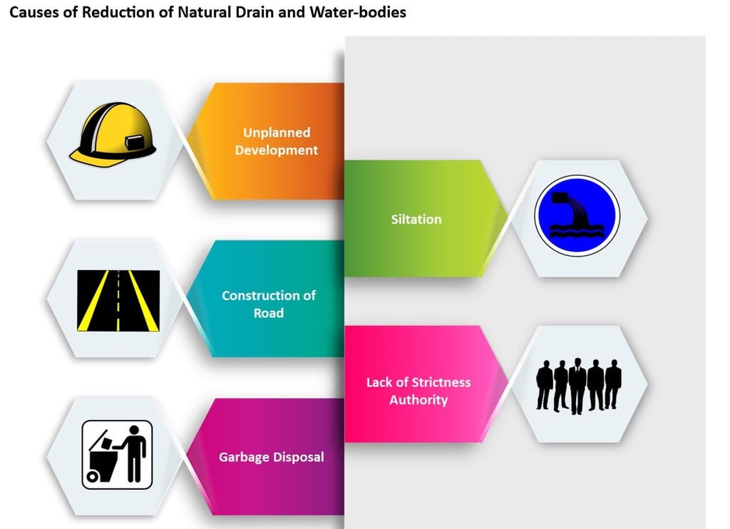

Unplanned development:
Rapid population increase and urban development with little or no regard for the environment The primary cause of natural drainage system loss is the natural drainage system. Many natural drains/khals were lost in Khulna city after the creation of highways, residential areas, bus terminals, etc. Over the last 15 years, many khals have been lost due to unanticipated causes in city expansion. Natural canals that have disappeared or are on their way out as a result of urban development projects are mentioned in the following points.
Siltation:
As the riverbed has been raised due to the unplanned construction of embankments and sluice gates across rivers and canals, siltation has become a problem in and around the embankment region. Riverbed elevation frequently hinders normal drainage. The construction of the Alutola Embankment on the Kazibacha River has already caused such an issue in Gallamary and other rivers. This situation will be exacerbated after Khulna's ongoing drainage project is completed. Plates 15 and 16 depict the enormous siltation issue.
Construction of roads:
Because government land is limited in the City, natural canal regions are frequently utilised for road development to save the public money. Several khals in Khulna City have vanished due to this unrealistic growth strategy. Road work is a typical occurrence along the khal. Some individuals build roads across the khal without using bridges or culverts. Many khals were lost as a result of road construction on them.
Lack of Strictly Authority:
Maintenance Drainage City Corporations, Pourashavas, and Municipalities create and maintain urban premises. Khulna City Corporation primarily supplies and maintains drainage facilities within its limits. Section 85 of the Khulna City Corporation Ordinance, 1991, included drainage facility rules. Other institutions with drainage development schemes and initiatives are the KDA, DOE, BWDB, LGED, and DRLS.
Garbage disposal:
According to a KCC report, 30.4 percent of households in the KCC territory dispose of their solid waste in KCC-provided dustbins. In comparison, the remaining 36.6 percent have no permanent location for trash disposal facilities. Outside the KCC region, just 15% of households have access to garbage disposal facilities, with the remainder having no set location. So waste disposal in natural drainage is a common occurrence, and this is still another leading cause of natural drain disappearance.
Solution From Case Study:
Water Log Problem & Flood Solution From Inspiration (Chennai Flood)
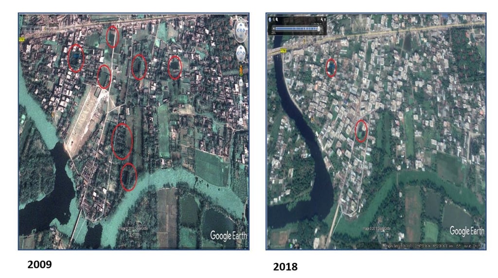
Bank Colony
Area of total reduces canals: 0.75 acres
'Shurimari Khal' was filled to develop Agrani Bank Colony
Responsible plot numbers: 5514,5542, and 5625
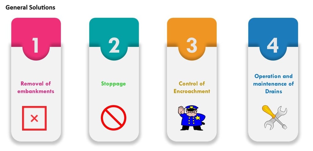

1. Removal Embankment
Cause:
Embankment Across Moyur River Near Buro Moulovir Bridge: The water development board built the Alutala sluice gate in 1980 to control tidal water at Krisnonagar, Harintana, Dubi, and Beel Pabla. However, shortly after the sluice gate was built, around 8000 bighas of cultivable land in Harintana and Dubi Mouza were deprived of necessary irrigation water. To provide proper irrigation for the agricultural area of the two mouzas, the landowners worked with the City Corporation authorities (then Pouroshava) to build an earthen embankment over Moyur River near Buro Moulovir Bridge in 1983, which they dubbed a water control sluice.
2. Stoppage:
Cause:
Embankment Across Moyur River Near Nirala R/A: On the southern side of the Nirala residential area, there was a wooden bridge over the Moyur River. This bridge was built to allow communication between Nirala and Harinlana. Local musclemen dismantled the bridge and constructed an earthen berm over the river in 1996. The water body between the embankment near the Buro Moulovir Bridge and the Nirala Residential Area is being used as Gher.
3. Control of Encroachment
Cause:
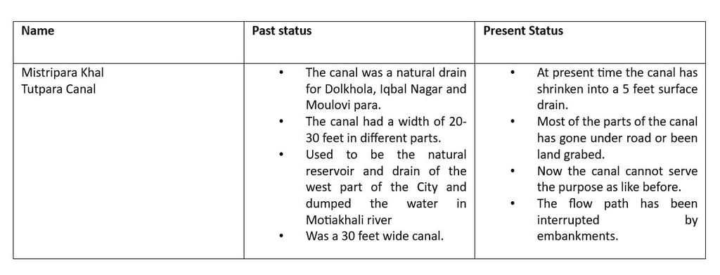
ENCROACHMENT: In Bangladesh, the procedure of encroaching on natural canals is frequent. Most of Khulna's natural channels have vanished or are on their way out due to illegal invasion by owners of nearby canal properties. The canal area is being seized year after year. Plates 8–10 illustrate private encroachment on Tutpara khal, Mistripara khal, and Mohibari khal, to name a few examples of such natural canal occupation.
4. Operation & Maintenance of Drains:
Cause:
Lack of operation and maintenance of drainage development work : Because of indiscriminate solid waste disposal, secondary and tertiary drains get clogged. All of the gutters and khals function as an arterial drainage system. As a result, drainage runoff from the City does not reach the nearest outfall. The pucca drains discharge into natural khals, and the outfalls have degraded due to infrequent operation and maintenance. Plates 16 and 17 depict two khal that require upkeep.


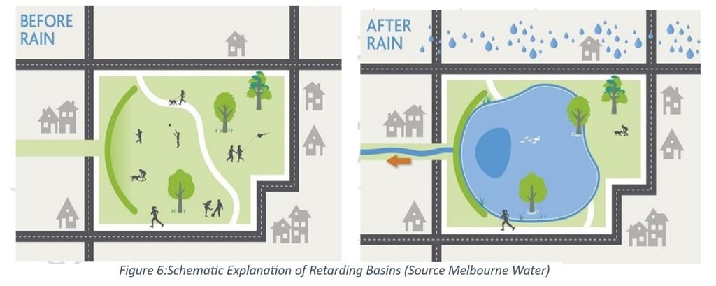
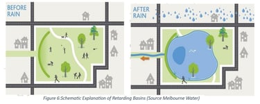
Retarding Basin (Melbourne) from Australia
Retarding basins play an essential function in managing stormwater in your local area. They are low-lying land areas that temporarily store stormwater during high rainfall. In Australia, they have collected over 200 retarding basins across Greater Melbourne, with many recreational areas for the community. They may be a grassy area available for recreation while dry or holding water permanently, which supports biodiversity. When a retarding basin fills, the landscape is designed to hold back stormwater to reduce flood risk to local homes and businesses. During this time, recreational areas may be affected. The stored water is then slowly released into the downstream drain or waterway.
Waste collection from Drainage Net: Inspiration
THE CITY OF KWINANA's achievement with drainage nets at Henley Reserve has piqued the interest of social media users. The City posted about the drainage nets on Facebook on Saturday, and 2.5 million people saw it within 48 hours. The effectiveness of the City's attempts to prevent rubbish flow from drainage systems was underlined in the article. The nets prevent solid garbage and major pollutants from being deposited into natural areas.
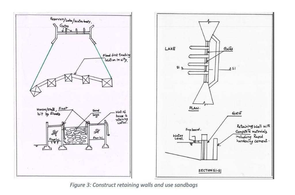
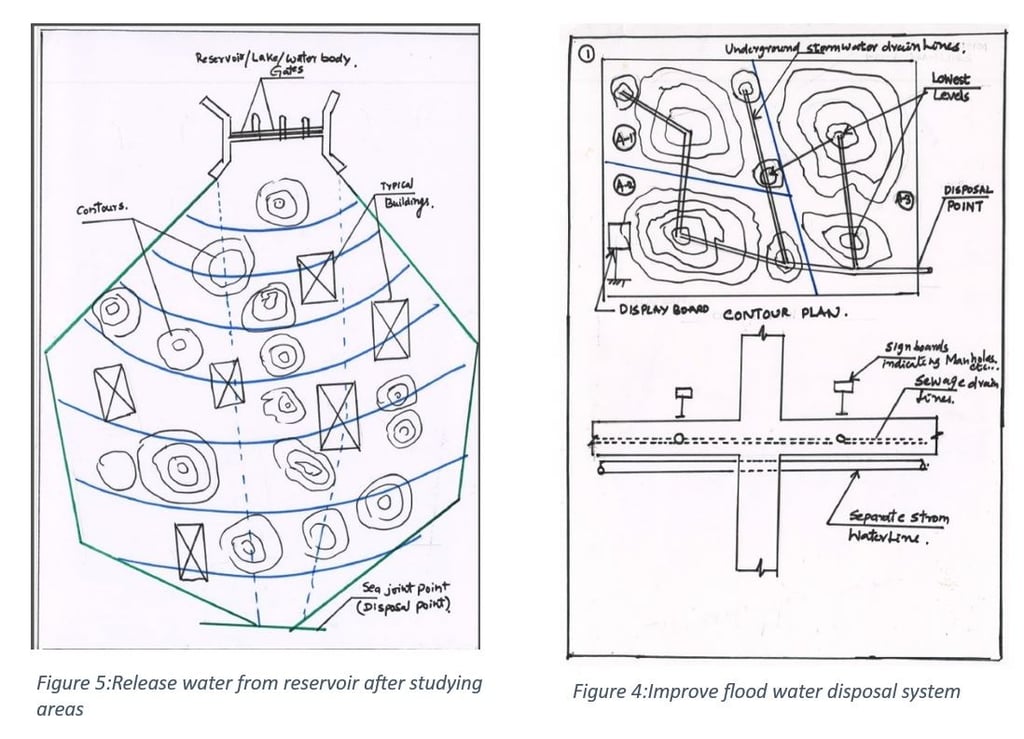
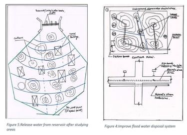
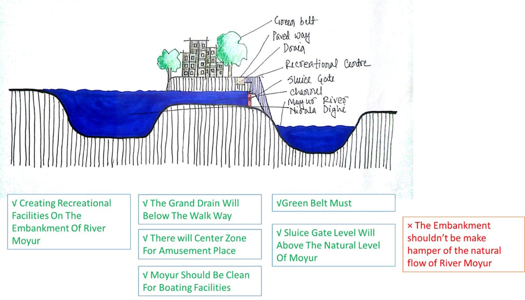
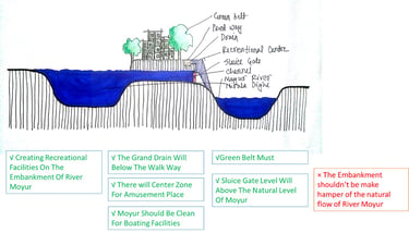
Final Solution:

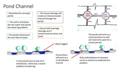
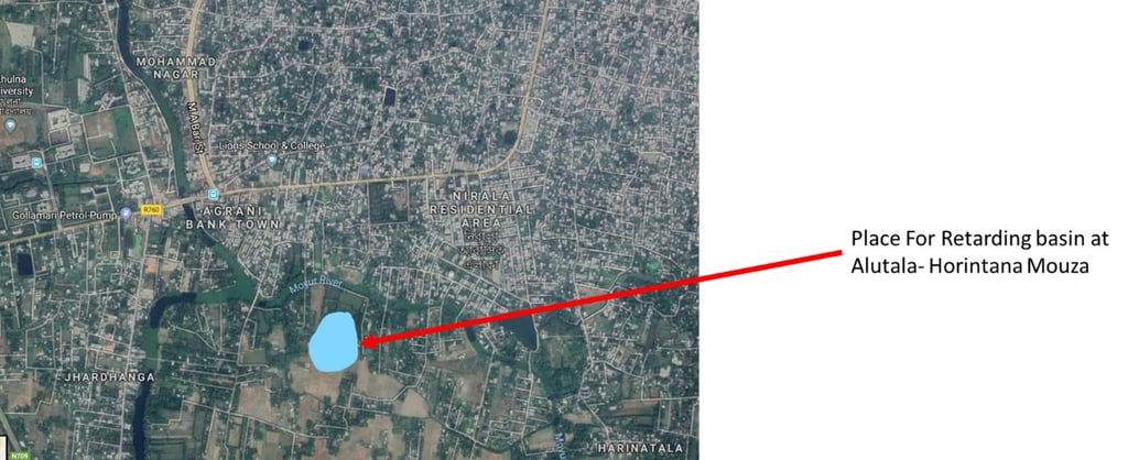
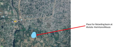
Proposal Diagram:
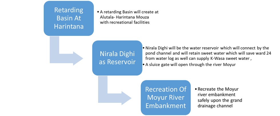
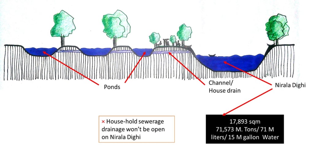
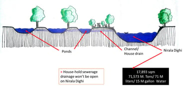
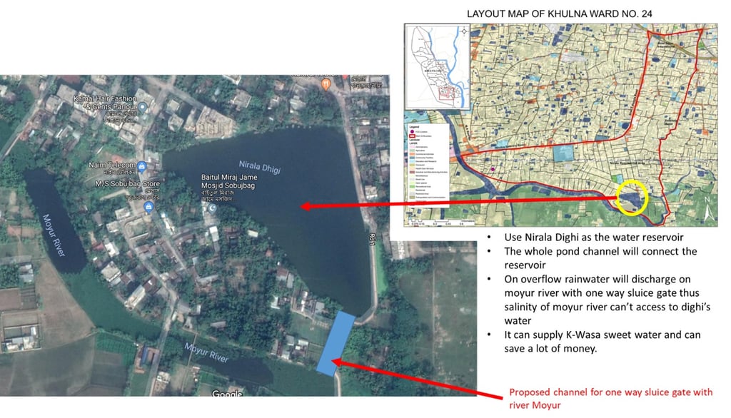
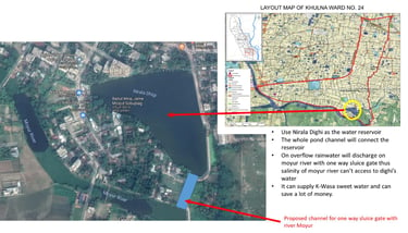
Nirala Dighi as Water Reservoir:
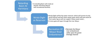
Problem At Horintana Mouza:
It has already been stated that an embankment spanning the Moyur River was built to irrigate the crop fields of Dubi and Horintana Mouza. However, the construction of this embankment has not only interrupted the regular drainage of the Mayur River but has also provided the opportunity for local musclemen to build more embankments on the same river. Immediate effort is required to ensure the Moyur River's regular drainage and provide irrigation facilities for Dubi and Horintana Mouza. The construction of a sluice gate at the Bure Moulovir Bridge in place of the current embankment can ensure normal drainage and irrigation facilities for the Dubi and Horintana Mouzas.
Meet The Author


Related ARTICLES
Related PROJECTS
Regeneration of urban public realm: At the Commercial Waterfront of Barobazar, Khulna
This project design supports how the commercial waterfront of the Baro Bazar can be developed as an urban space, which will be used for human service and human welfare. At the same time, one of the objectives of this project is to retrofit the entire riverfront with its surroundings. One of the targets of this project is to restore the declining economic progress and the lost importance of the ghats. The entire project has been completed in the renovation and regeneration process.
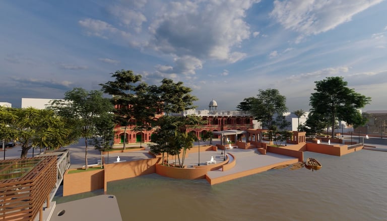
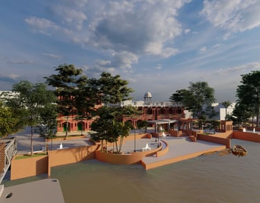
Image: Waterfront Regeneration at Barobazar Delta Ghat
Location: KUET, Khulna; Year: 2020